Aerial surveying is a common method for gathering information about a wide range of topics, from land development to conservation and climate change. There are several different techniques used for aerial surveying, depending on the type of information that is being collected and the conditions of the area being surveyed. Perhaps the most commonly used method is drone aerial surveying, which involves using remotely-operated aerial vehicles equipped with advanced cameras and sensors to capture aerial images and data. Alternatively, aerial surveys can also be performed using helicopters or fixed-wing aircraft. Whichever technique is used, aerial surveying provides valuable insights into issues such as land use, resource availability, and environmental changes over time. In addition, this approach allows for extensive coverage of large areas in a much shorter amount of time than traditional methods like on-the-ground surveys or satellite imaging. Whether you’re conducting an academic study or performing commercial aerial surveying, these techniques are sure to give you the tools you need to get accurate results and how we perform aerial surveys in Melbourne.
The three major types of surveys
There are three main ways aerial surveys are performed. They are:
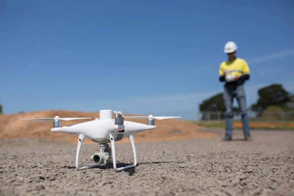
Drone Aerial Surveys
Drone aerial surveying is an emerging field that has revolutionized the way that we collect data about our environment. Using high-resolution aerial photos, drone aerial surveying allows us to get a bird’s eye view of our surroundings, providing a detailed picture of everything from topographical features to plant and animal life. Not only does this technology allow us to conduct more accurate studies, but it also helps us to identify potential hazards and environmental issues more quickly and easily. Whether used for scientific research or disaster response, drone aerial surveying is an invaluable tool for understanding and protecting our natural world.

Drone Survey Advantages
Drone aerial surveying is a fast and cost-effective way to gather information from large geographic areas. Compared to traditional methods of aerial surveying, such as using manned aircraft or satellite imagery, drones provide a much more detailed and precise picture of the landscape. This is due to several factors, including their ability to maneuver through tight spaces and their ability to capture high-resolution images. In addition, drones are able to capture aerial surveying data in real time, eliminating the need for expensive post-processing software and manual analysis. Overall, these advantages make drone aerial surveying an indispensable tool for land management professionals working on large projects over wide geographic regions.
Drone Survey Disadvantages
There are several major disadvantages associated with aerial surveying using drones or other aerial vehicles. One of the most significant challenges is that aerial surveying often requires specialized equipment, meaning that it can be difficult to find affordable and reliable options. In addition, drones must navigate through complex terrain and weather conditions, which can increase the risk of accidents or malfunctions. Another issue is that aerial surveys can interfere with air traffic, resulting in unpredictable delays and disruptions for passengers and workers. Finally, both aerial surveys and drones are vulnerable to theft or destruction from bad weather or accidents, which can be costly and time-consuming to replace. Overall, while aerial surveying using unmanned aerial vehicles has a number of benefits, it also comes with several significant drawbacks.
Helicopter Aerial Surveys
Helicopter aerial surveying is a valuable tool for capturing aerial images of large areas in a short amount of time. This method of surveying uses specialized helicopters equipped with cameras and sensors to collect aerial data about land formations and features. Depending on the needs of the survey, the aerial images could be used to map out urban planning or geological features, or even track changes in vegetation over time. Regardless of the intended use, helicopter aerial surveying offers an efficient and cost-effective way to gain a comprehensive view of large areas from above. Whether you’re looking to understand shifts in vegetation patterns or identify specific geological formations, helicopter aerial surveying can be an extremely useful tool for getting high-resolution, accurate aerial data.
Helicopter Aerial Surveys Advantages
One of the primary advantages of aerial surveying is that it allows researchers to easily gather data from a wide range of locations. Helicopter surveying can be used to cover various types of terrain, including difficult or mountainous areas that would be challenging or impossible to reach on foot. As an added bonus, aerial surveys can be conducted quickly and efficiently, allowing researchers to gather large amounts of information in a relatively short amount of time. Another benefit of aerial surveying is that this technique can often yield more accurate results than land-based methods, as aerial observations are less affected by variables such as vegetation and topography. Overall, then, aerial surveying represents a highly effective approach for gathering scientific data about the natural world.
Helicopter Aerial Surveys Disadvantages
While aerial surveying via helicopter has many advantages, including the ability to quickly cover large areas and collect large amounts of data, it also comes with several disadvantages. One major drawback is the cost associated with aerial surveys. High-tech aerial mapping equipment can be very expensive, both to purchase and to maintain. In addition, helicopters are often used for other purposes in addition to aerial surveying, which means that there may be additional costs associated with the use of helicopters for this particular activity. Furthermore, aerial surveying is not always a reliable method for gathering data about smaller or more remote areas due to factors such as low visibility or limited accessibility. As a result, while aerial surveys are a useful tool in many circumstances, they also have their limitations and should be carefully considered when planning any aerial mapping project.
Plane Aerial Surveys
Fixed wing aerial surveying is a type of aerial surveying that involves using fixed-wing aircraft to obtain aerial images. This technique allows for the collection of precise data, such as measurements and aerial imagery, in large areas at high speeds. Unlike other types of aerial surveying, which rely on helicopters or drones for aerial imaging, fixed wing aerial surveying is able to cover larger areas more quickly and with greater accuracy. Additionally, this method requires less up-front investment than other types of aerial surveying and typically results in lower operational costs. Overall, fixed wing aerial surveying is a valuable tool for researchers and professionals working in a range of fields, including mapping, agriculture, ecology, and infrastructure planning. Whether you are looking to monitor changing terrain over time or evaluate the condition of an expansive forest region, fixed wing aerial surveying offers an effective way to gather accurate information about your surroundings.
Plane Aerial Surveys Advantages
One of the key advantages of fixed wing aerial surveying is its versatility and flexibility. Unlike rotary-wing aerial survey platforms, which are limited to slow, low-altitude flight paths, fixed wing aerial platforms can fly much higher and more quickly. This allows them to survey very large areas in a fraction of the time, which makes them useful for larger agricultural projects or land management initiatives that require accurate mapping and monitoring over large areas. Additionally, the levels of precision that aerial surveying can achieve make it a valuable tool for environmental scientists and other researchers who are studying trends in bird populations or vegetation distribution over long periods of time. Overall, by providing fast, accurate data about our world from above, fixed wing aerial surveying offers a unique and indispensable perspective that no other method can match.
Plane Aerial Surveys Disadvantages
While aerial surveying offers many benefits to businesses and organizations, there are also a number of drawbacks associated with this method of data collection. One disadvantage is that fixed wing aerial surveying can be an extremely costly process. Because aerial surveying aircraft often require specialized pilots and the need for launching and recovery equipment, operating aerial survey planes can be expensive. In addition, the high costs may put some companies out of reach for small-scale or local projects, limiting the availability of aerial mapping services to certain sectors of the economy.
Another disadvantage of aerial surveying is that it can lead to errors in collected data. Since aerial photographs are taken at specific heights and intervals above ground level, slight changes in terrain can impact data accuracy. For example, if a hillside appears flatter in aerial photographs than it actually is in real life, this could result in the measurement of incorrect distances or elevations on a map or virtual model. As a result, it may be necessary to employ additional resources or conduct additional surveys to verify and correct any inaccuracies present in aerial survey data.
Wrapping up Aerial Surveys
Aerial surveying provides an efficient and effective means for obtaining accurate data across large tracts of land. When choosing an aerial surveying company, be sure to consider the experience of the surveyors, the quality of equipment used, and the specific requirements of your project. With careful planning and execution, aerial surveys can provide detailed information about even the most remote areas.