The accuracy of a LiDAR survey can be 0.5 to 10mm relative to the sensor. This is dependent on the type of LiDAR you use. A LiDAR survey is a highly accurate inspection method that uses lasers to measure distances. LiDAR surveys are often used to create 3D models of objects or landscapes.
What effects Lidar Accuracy?
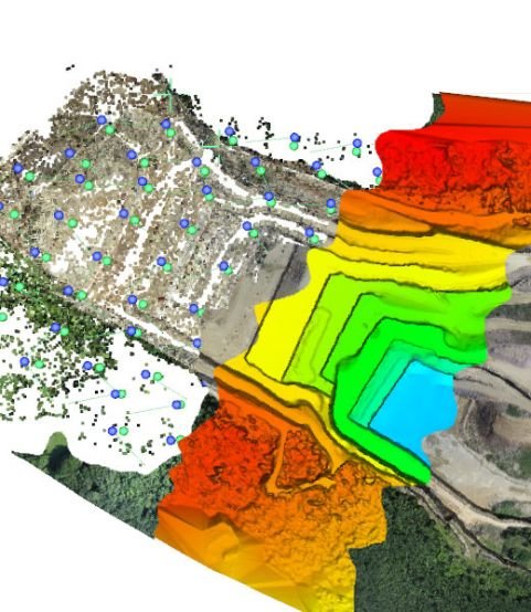
The accuracy of a LiDAR survey depends on several factors, including the type of LiDAR system used, the distance between the laser and the object being measured, and the reflectivity of the object.
LiDAR systems can achieve an accuracy of up to 0.5 to 10mm relative to the sensor. However, for long-range measurements or measurements of highly reflective objects, the accuracy may be lower. Want to know? Is LiDAR more accurate than photogrammetry? Then read on here.
How detailed can LiDAR be?
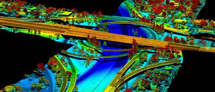
LiDAR is a highly detailed mapping technology that uses laser light to precisely measure distances between points on the Earth’s surface. This allows LiDAR surveys to capture incredibly precise information about everything from topography and land use to environmental factors like temperature and soil composition. By combining this data with other forms of geospatial information, such as imagery and satellite data, LiDAR can provide a more complete picture of what is happening on the ground. Thanks to its high level of detail, LiDAR has become an invaluable tool for researchers, governments, businesses, NGOs, and other organizations. Whether assessing risk for natural disasters or tracking changes in land use over time, LiDAR allows us to better understand our world and make informed decisions about how we use and protect it.
Depending on the type of system you are using will impact the accuracy. For example if you are using a SLAM based system the accuracy will be much lower. Generally a SLAM based system will get you about 20mm relative accuracy. Compared to a terrestrial scanner you can get 1-3mm accuracy within the point cloud.
Does LiDAR penetrate vegetation?
When conducting lidar surveys, there is often a lot of vegetation that can interfere with data collection. This is because lidar relies on light signals to create spatial information about an area, and dense foliage absorbs much of this signal. However, recent research has shown that lidar can still effectively penetrate even the thickest vegetation. This is possible due to lidar’s relatively high pulse repetition frequency (PRF), which creates a strong signal even in deeply shaded areas. Additionally, new lidar technology uses multiple laser beams on each shot to further increase the signal-to-noise ratio and reduce the impact of absorption from leaves and branches. Overall, lidar remains one of the best tools for collecting accurate spatial data despite its limitations caused by vegetation cover.
We cover the various 3d laser scanning use cases here.
What are the best Lidar Brands?
To ensure the highest possible accuracy, it is important to choose a reputable LiDAR provider and to carefully consider all factors that could affect the scan.
LiDAR brands such as Riegal, Faro , Trimble, Leica Geosystems, and Z+F make high-quality scanners that are suitable for a variety of surveying applications.