The key advantages of an aerial survey are:
- fast capture speed
- great visualization
- reduced costs
In fact most projects are able to be captured in a single flyover with little to no disruption to operations or the general public.
Fast Capture Speed
By completing a survey from the air it drastically decreases the time for you to better understand the area of interest. Compared to traditional methods such as terrestrial surveying you can capture the area in far less than half the time.
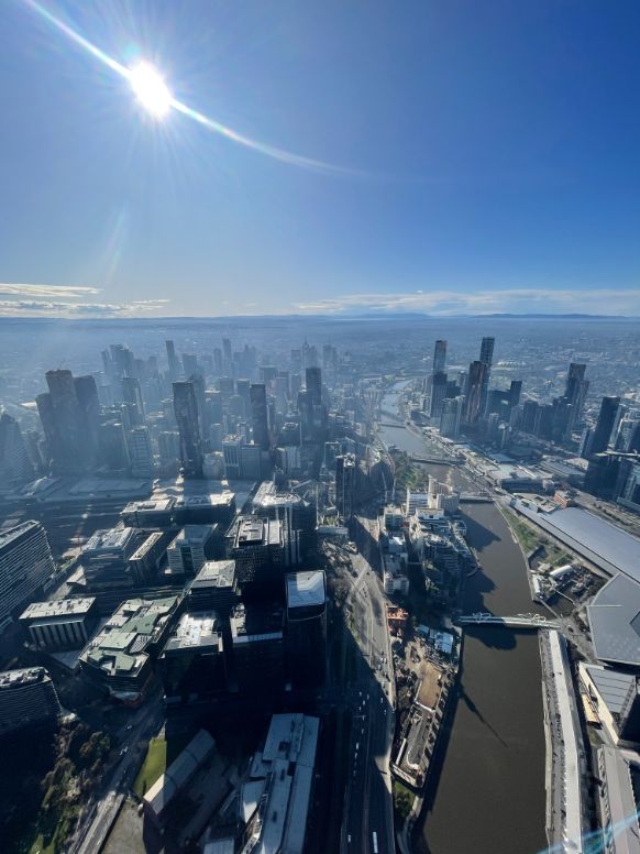
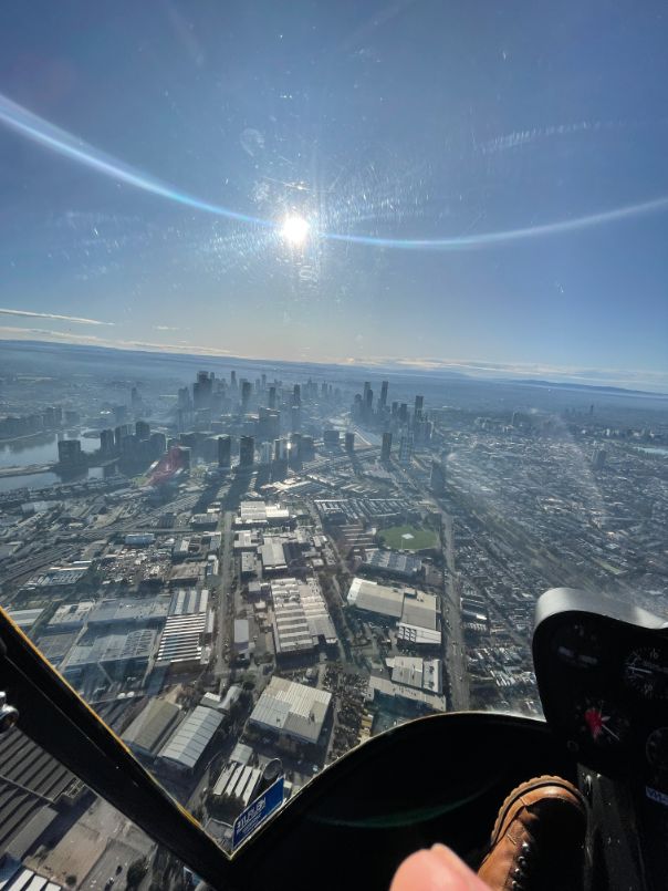
Great Visualization
Aerial surveying is like having google maps but on steroids. You will have imagery that can be less than 1cm GSD allowing you to have a detailed understanding of what the area looks like. Compare this to standard a traditional survey where you have no imagery of the area it is chalk and cheese on the type of information you can provide your client.
Reduces cost
Who doesn’t love saving money. Not only can you save money but you can also make more money. Just because you are reducing your time on site or to complete the job doesn’t mean you cannot charge the same amount. This is easily justifiable to your client by providing them with more information than you usually would for the same price.
What Are Aerial Surveys Used For?
• Completing large detail surveys for construction, transport & infrastructure
• Monitoring of construction & site development
• Volumetric calculations for bulk earthworks, stockpiles & landfill
• Hazard assessments
• Disaster & environmental monitoring
• Major sporting events
It is also ideal for locations with difficult access or high traffic where drones cannot be used (pedestrian or vehicle) which would be impacted by shutdown periods.
Aerial surveying, also known as Photogrammetry or Aerial Mapping, (or aerial inspection), has been around for years. Advancements in technology and ease of data collection have allowed it to remain at the forefront of survey methods. Once the data is captured it can be further processed to create high resolution orthographic images, digital elevation models and point-clouds giving clients additional deliverable options.
What is photogrammetry?
Photogrammetry is the science of making accurate measurements from photographs. It’s what we use to turn photos into highly accurate 2D or 3D models, whether that’s a topographic survey for a mining project or as-built documentation of a construction site.
What Are The Benefits of Using Photogrammetry?
No Ground Control Points (GCP)
No GCP’s are required as the software “triangulates” off known features in the images to generate accurate mapping results. The absolute accuracy will be reduced when not using GCP’s but you do not need them to create the end deliverable. If you do need high absolute accuracy then GCP’s are required.
Fast Mapping
Photogrammetry is a powerful aerial mapping technique that relies on taking images from above in order to accurately measure and identify different features. By analyzing these aerial images, photogrammetry can extract information about the size, shape, and location of certain structures or landforms, as well as identify known objects such as roads, bridges, or buildings. This allows for fast and accurate mapping results that are especially useful in remote areas where traditional surveying techniques may be impractical. Additionally, because the aerial images are digitized automatically by specialized computer software, photogrammetry offers a much more efficient way to make measurements and gather data than conventional techniques like using ground level sensors or surveyors on foot. Overall, photogrammetry is an extremely effective aerial mapping solution that provides critical information for everything from disaster relief to city planning.
Capture hard-to-access areas no ease
Photogrammetry is a powerful tool for capturing aerial data of hard-to-access areas. By taking photos from various vantage points, you can create detailed maps and models that give you a better understanding of your environment. Whether you are mapping out natural terrain or documenting a construction site, photogrammetry allows you to gather data from difficult locations with no hassle. And since this approach uses aerial imaging rather than on-the-ground surveying methods, you can use planes, helicopters, or even unmanned aerial vehicles (UAVs) to collect the necessary data. Ultimately, photogrammetry makes it easy for anyone to capture and analyze hard-to-access areas with no effort at all.
If you are wanting to learn more on how aerial surveying can help you and your workflow make sure you get in contact today.